Family Friendly Adventures
Lamb’s Head Pier
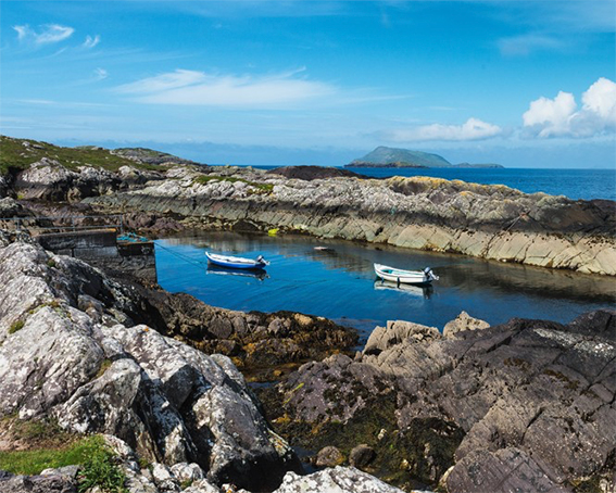
Caherdaniel to Lamb’s Head pier is a breathtaking route that hugs the edge the headland alongside the stunning Derrynane Bay. On reaching the pier, why not take the short climb to the brow of the headland where a WWII lookout tower stands with spectacular 360-degree views. Close by you’ll find an Éire sign constructed using whitewashed stones to warn both Allied and Germans bombers that they were flying over a neutral country. Afterwards, cool down by taking the plunge off the pier, tide permitting, of course!
- Category: Family friendly – Something for everyone!
Ring of Coom
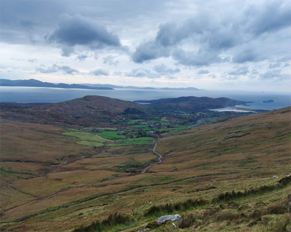
The Ring of Coom is a lovely little loop that starts in Caherdaniel village and climbs inland through the townlands of Garrough and Coomnahorna. Here you have two options – If you want to tire the kids out head up the low road past Caherdaniel Garden Centre and on to Coom Cottage. This route has a gradual incline throughout. If you’d prefer an easier option, follow the main Waterville road past Caherdaniel National School and take the first right. From here the road is level all the way to Coom Cottage, while ye get to enjoy a nice freewheel back down to the village.
A great additional option to lengthen out this route is to dock the bikes at The Farmhouse and stay going on foot up the hill. This road will lead you right to the top where the road splits. Hang a right onto the bog road to see one of the very few locations where turf is still cut by hand to this day. While the western road boasts a gorgeous view of Lough Currane, Waterville and beyond.
- Category: Family friendly – Something for everyone!
Beaches of Rath & Been

Another family orientated option is to pack a picnic and enjoy a relaxing day at the beach. While Derrynane will always be a crowd favourite, why not sample a few of Caherdaniel’s lesser-known beaches such as Rath and Reen. Both are easily accessible by bike, and the perfect option for a chilled-out day – What else are holidays for!
You’ll find the turn off for Rath between Caherdaniel village and Wavecrest caravan park, while Reen is a further 1.5 kilometres towards Castlecove. Here you’ll be able to take advantage of the new cycle lane constructed between O’Carroll’s Cove and Reen.
- Category: Family friendly – Something for everyone!
Bike & Hike Adventures
Coomnahorna

From Caherdaniel village take the Coomnahorna road, continuing up the valley for 2km until you reach the SKC dock and lock station at The Farmhouse. Set off on foot up the hill road which zig zags right to the top before splitting in two. Both roads continue for another kilometre, however, there’s still plenty to see if you carry on a little further. If you take the bog road to the right, cross the wire at the end of the road and continue over the brow of the hill, you’ll get a spectacular elevated view of Coomrooanig lake in the Glenmore valley. If you keep going beyond the end of the western road that swings around to the left, you’ll reach the summit of Cahernageeha, which is marked by an Ordnance Survey triangulation point. Again, the views from the top are something to behold.
- Category: Bike & Hike – For those wishing to really stretch those legs this is just the ticket for you!
Coad
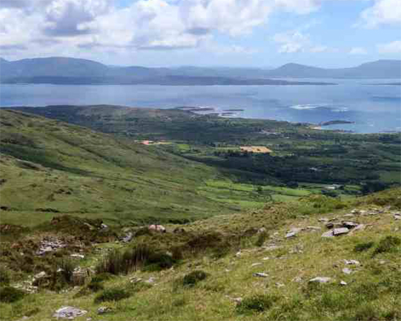
The townland of Coad lies midway between O’Carroll’s Cove and Castlecove village. From the main road, it’s a gentle pedal up as far as Coad burial ground where you can secure the bikes before setting off on foot. Follow the road to the left, beyond the garage until it runs out into the Kerry Way. From here the path winds back around in an easterly direction and climbs to the Windy Gap, the saddle between Eagle Hill and Staigue. One can return down the same route, however, those seeking a real challenge will no doubt take on the steep climb to the top of Eagles Hill before descending to re-join the path as it leads back to your starting point.
- Category: Bike & Hike – For those wishing to really stretch those legs this is just the ticket for you!
Coomnahorna
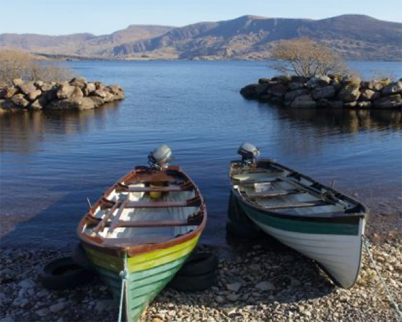
From Caherdaniel village take the Coomnahorna road, continuing up the valley for 2km until you reach the SKC dock and lock station at The Farmhouse. Set off on foot up the hill road which zig zags right to the top before splitting in two. Both roads continue for another kilometre, however, there’s still plenty to see if you carry on a little further. If you take the bog road to the right, cross the wire at the end of the road and continue over the brow of the hill, you’ll get a spectacular elevated view of Coomrooanig lake in the Glenmore valley. If you keep going beyond the end of the western road that swings around to the left, you’ll reach the summit of Cahernageeha, which is marked by an Ordnance Survey triangulation point. Again, the views from the top are something to behold.
From Caherdaniel village take the Coomnahorna road, continuing up the valley for 2km until you reach the SKC dock and lock station at The Farmhouse. Set off on foot up the hill road which zig zags right to the top before splitting in two. Both roads continue for another kilometre, however, there’s still plenty to see if you carry on a little further. If you take the bog road to the right, cross the wire at the end of the road and continue over the brow of the hill, you’ll get a spectacular elevated view of Coomrooanig lake in the Glenmore valley. If you keep going beyond the end of the western road that swings around to the left, you’ll reach the summit of Cahernageeha, which is marked by an Ordnance Survey triangulation point. Again, the views from the top are something to behold.
e-Bike Adventures
Loher Fort & Hogs Head
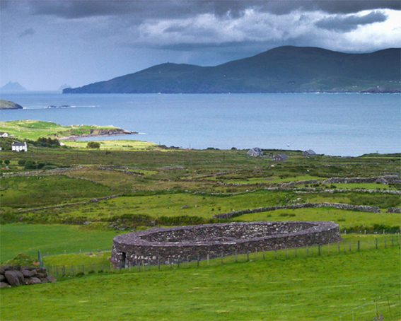
This route has much to offer as you can combine history and spectacular Atlantic views with a sea swim and lunch in Waterville should you wish. Hang a left after Loher church and take the high road back to Loher fort to begin with. Dating from the 9th century, this old caher is one of a number of fine examples of stone forts to be found in the parish. Next, take the low road that winds around to the seaward side of the headland to get some spectacular snaps with the UNESCO world heritage site, Skellig Michael, in the backdrop. On your way back you could take a dip at Toor Beach before pedalling on into Waterville to enjoy a well-earned bite of lunch.
- Category: eBike Adventures – Routes that require that little bit extra!
Gleesk
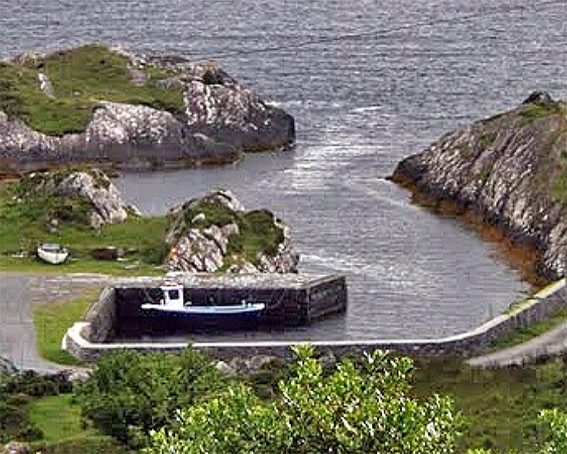
This route has much to offer as you can combine history and spectacular Atlantic views with a sea swim and lunch in Waterville should you wish. Hang a left after Loher church and take the high road back to Loher fort to begin with. Dating from the 9th century, this old caher is one of a number of fine examples of stone forts to be found in the parish. Next, take the low road that winds around to the seaward side of the headland to get some spectacular snaps with the UNESCO world heritage site, Skellig Michael, in the backdrop. On your way back you could take a dip at X beach before pedalling on into Waterville to enjoy a well-earned bite of lunch.
- Category: eBike Adventures – Routes that require that little bit extra!
